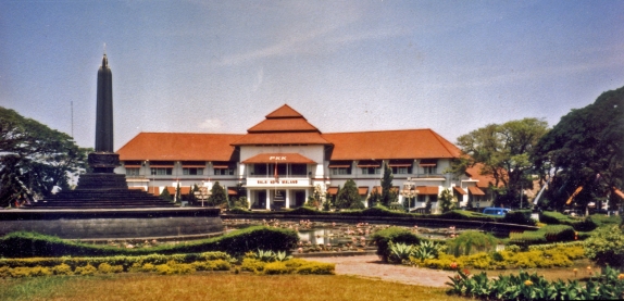
Like we said before, Indonesia is the largest archipelago in the world. which is the most well known islands are Sumatra, Java, Bali, Kalimantan (Borneo), Sulawesi (Celebes), and Papua. First, we want describe about Sumatra.
SUMATRA ISLAND

Sumatra Island is one of the major islands in Indonesia, located in the western part of the Indonesian archipelago, bordering the Indian Ocean the west, the Bay of Bengal to the north, the Strait of Malacca in the east and to the south of the Sunda Strait. Area of the island is approximately 443,085.65 km2, is the sixth largest island in the world. Some of the names are often used to refer to the island especially in the past is Andalas, Swarnadipa. In the administration of the island of Sumatra is divided into 10 (ten) provinces namely Aceh, North Sumatra, West Sumatra, Riau, Jambi, South Sumatra, Bengkulu, Lampung, Bangka Islands, Riau Islands.
If viewed by boundary region, north of Sumatra Island bordering the Bay of Bengal, the eastern side of the Strait of Malacca, south of the Strait of Sunda, and west to the Indian Ocean. In the east of the island, found many swamps drained by large rivers, among others. In the western part of the island, lies the Bukit Barisan that stretches from north to south. Only a few areas of the island is suitable for rice farming. Along the line of the hill there are volcanoes that are still active, such as Mount Merapi (West Sumatra), Bukit Kaba (Bengkulu), and Kerinci (Jambi). Sumatra also has many lakes, including lakes Freshwater Sea (NAD), Lake Toba (North Sumatra), Lake Batur, Maninjau, Above and Below (West Sumatra), Ranau lake (South Sumatra), It’s Not Revenge lake and Lake Test (Bengkulu).
Sumatra Island is an island rich in agricultural products. Of the five provinces rich in Indonesia, there are three provinces on the island of Sumatra, the province of Aceh, Riau and South Sumatra. The results of the main island of Sumatra is Palm Oil, Tobacco, Petroleum, Tin, Bauxite, Coal and Natural Gas. Producing area of the mine on the island of Sumatra and the resulting mine types are generated in the Arun natural gas, petroleum produced in Pangkalan Brandan, Duri, Dumai, Bengkalis, Palju and Gerong river. Coal produced in Tanjung Enim. Tanjung Pinang produces bauxite and tin produced in Muntok.
JAVA ISLAND
 Java island located at the southern of Indonesia. Geographically, Java island located at the southern of Indonesia. To the west is bordered by Sumatran island, and on the east by Bali island. To the north is bordered by Java Sea. The island of Java Indonesia is administratively divided into six provinces: Banten, West Java, Central Java, East Java, Yogyakarta Special Region, and Capital District of Jakarta. Five largest and most popular cityIndonesia are in Java, namely Jakarta, Bandung, Surabaya, Yogyakarta, and Semarang.
There are approximately 136 million people live on this island. The majority ethnic population of Java island is Javanese and Sundanese. In general, the Javanese inhabiting the center and eastern part of Java while the Sundanese in the the western area. Although, now the island of Java has been lived with various ethnic groups from all over the world.
Java also has many mountains as a result of volcanic processes that are also believed to be one of the formation triggers of this island. One of the most active volcano in Java namely Mount Merapi (2968 m). While the highest mountain in Java is Mount Semeru or Mahameru (3676 m).
BORNEO ISLAND

Borneo is the third largest island in the world (after Greenland and New Guinea, and comprises three separate countries: Malaysia (Sabah and Sarawak), Indonesia (Kalimantan) and the Sultanate of Brunei. Located southeast of the Malay Peninsula and southwest of the Philippines, Borneo is primarily mountainous, with dense areas of rain forest. The highest peak in Borneo, Mt. Kinabalu, stands at 13,455 ft. With a generally hot, wet climate, rain is more common than not, with some portions of Borneo receiving between 150 and 200 inches of rainfall annually. Between October and March, monsoons buffet the island.
Geographically, Borneo is surrounded by the South China Sea to the north and northwest, the Sulu Sea to the northeast, the Celebes Sea and the Makassar Strait to the east, and the Java Sea and Karimata Strait to the south. To the west of Borneo are the Malay Peninsula and Sumatra. To the south is Java island. To the east is Sulawesi, and to the northeast, the Philippines.
Given the abundance of rainfall, it makes sense that Borneo’s flora is among the most diverse in the world. Borneo has nearly 11,000 species of flowering plants, about a third of which are indigenous. How dense is the vegetation? In one 16 acre area of Borneo’s lowland forest, over 700 species of trees have been recorded. In comparison, there are only 171 native tree species in all of eastern North America.
The Borneo jungles contain some of the oldest undisturbed areas of rainforest in the world. Some of the best and most spectacular areas of rainforest have been incorporated into National Parks, which to some extent, are a good enough reason to make the effort to visit Borneo. You cannot help but be captivated by the wonderful diversity of plant and wildlife to be found.
Borneo’s forests are some of the most biodiverse on the planet. According to WWF, the island is estimated have at least 222 species of mammals (44 of which are endemic), 420 resident birds (37 endemic), 100 amphibians, 394 fish (19 endemic), and 15,000 plants (6,000 endemic) — more than 400 of which have been discovered since 1994. Surveys have found more than 700 species of trees in a 10 hectare plot — a number equal to the total number of trees in Canada and the United States combined.
SULAWESI ISLAND

Formerly known as Celebes, Sulawesi is shaped like a tropical orchid. It is Indonesia’s third-largest island with an area of 172,000 square km. The island of Sulawesi is divided into the provinces of North Sulawesi, South Sulawesi and Southeast Sulawesi. Sulawesi has great topographical variety-spectacular mountains, scenic coastline, lakes, rice and dense jungles-and offer wonderful opportunities for travelers.
Sulawesi surrounded by Borneo to the west, by the Philippines to the north, by Maluku to the east, and by Flores and Timor to the south. It has distinctive shape, dominated by four large peninsulas: The Semenanjung Minahassa, The East Peninsula, The South Peninsula, and The South-East Peninsula. The central part of the islands s ruggedly mountainous, such that the island’s peninsulas have traditionally been remote from each other, with better connections by sea than by road
Geographically, strait of Sulawesi is known as the border of Wallace Line which separates two different kind of fauna between the eastern and westren part of indonesia it has a spesific flora and fauna such us ebony wood, hog-deer, and Maleo Bird which has large eggs. Altough not species rich relative to Borneo or Java, Sulawesi is high in endemicity because of its long isolation from Asia and Australian in Wallacea. This ecoregion exhibits high plant endemic, mammals in Asia and several endemic bird
The island is sub divided into six provinces: Gorontalo, West Sulawesi, South Sulawesi, Central Sulawesi, South-East Sulawesi, and North Sulawesi. The largest cities on the islands are Makassar, on the southwestern coast of the island, and Manado, on the northern tip.
The name Sulawesi probably origins from “Sula” which means island and “besi” from iron, which was formerly known as Celebes is a beautiful island. it has an area about 227,000 km2 with the long and narrow peninsulas. There is no more 90 km spot of land from the seashore, this make the island has along beach line. It is an island with very beautiful seashore and highland scenery. One can see and enjoy the uniqueness of this culture such as ceremonial, traditional dance, carving, beautiful weaving from cotton and silk, traditional house and fascinating natural tropical scene.
Major income on Sulawesi is agriculture and fishing. Some of the products exported from the region are spice, fruit, maze, rice, tobacco, coffee, and sugar. There is also some mining industry here, mainly for gold, copper, tin, and diamonds.
PAPUA ISLAND

Located in the north east of Papua New Guinea, the Islands Region comprises Bismarck Archipelago and North Solomon Islands and is the least densely inhabited region with a population of 750,000 (14% of PNG).
Administratively, the region is divided into five provinces – East New Britain, Manus, New Ireland, Bougainville and West New Britain. This region offers a raft of sea and land experiences – snorkelling, swimming, kayaking, walking, climbing, fishing, shopping, arts and crafts.
Papua New Guinea occupies the eastern half of the rugged tropical island of New Guinea(which it shares with the Indonesian territory of Irian Jaya) as well as numerous smaller islands and atolls in the Pacific. The central part of the island rises into a wide ridge of mountains known as the Highlands, a territory that is so densely forested and topographically forbidding that the island’s local peoples remained isolated from each other for millennia. The coastline is liberally endowed with spectacular coral reefs, giving the country an international reputation for scuba diving. The smaller island groups of Papua New Guinea include the Bismarck Archipelago, New Britain, New Ireland and the North Solomons. Some of these islands are volcanic, with dramatic mountain ranges, and all are relatively undeveloped.
Papua MapNearly 85 percent of the main island is carpeted with tropical rain forest, containing vegetation that is a combination of Asian and Australian species. The country is also home to an impressive variety of exotic birds, including virtually all of the known species of birds of paradise, and it is blessed with more kinds of orchids than any other country.
Papua New Guinea’s climate is tropical, as one would expect in a country located just south of the Equator. December to March is the wet season, although occasional rain falls year-round. While Port Moresby, the capital, and other towns on the coast are quite hot in the summer months, temperatures are considerable cooler in the Highlands. July, August, and September are the best months for trekking vacations.
BALI ISLAND
 At last but not least, Bali Island. The island is located in the westernmost end of the Lesser Sunda Islands, lying between Java to the west and Lombok to the east.
Bali Islands is one of the thousands islands constructing the Indonesian Archipelago that has long been famous as a leading tourist destination in South Pacific or even in the world for its exotic and vibrant art and culture, natural beauties and the hospitality of the people. Bali islands covers an extent of 5,632.86 square kilometers consisted of mountain range stretches from the West tip to the East.
Hinduism is adhered by almost 95% of its population of more than 3 millions people, specifically blended with Buddhism and the Ancestor’s worship. It is made inseparable from everyday life and no opportunity is missed to worship Gods in an unending series of ceremony stretches from birth up to after death.
Bali Islands has such a mild and agreeable climate the wholeYear round, with average temperature of the day in coastal areas varies from about 28C (82F) during May-July to abut 30C (86F) in March-October, while the most pleasant weather is between May-September.
REFERENCE(s):
http://www.baliisland.org/ (accessed 19 November 2012)
http://www.javaindonesia.org/ (accessed 19 November 2012)
http://www.mongabay.com/borneo.html (accessed 19 November 2012)
http://www.papuanewguinea.travel/islandsregion (accessed 19 November 2012)
http://atlasnasional.bakosurtanal.go.id/fisik_lingkungan/fisik_lingkungan_detail.php?id=2&judul=Sumatera (accessed 19 November 2012)
http://www.indonesiapoint.com/tourist-attractions/sulawesi.html (accessed 19 November 2012)
http://www.sulawesi-experience.com/sulawesi-island-tourism-destinations.html (accessed 19 November 2012)
http://www.javaindonesia.org/general/an-overview-of-java-indonesia/ (accessed 19 November 2012)
http://www.geographia.com/papua-newguinea/ (accessed 19 November 2012)
http://www.papuanewguinea.travel/islandsregion (accessed 19 November 2012)
http://www.pbs.org/edens/borneo/awesome.html (accessed 19 November 2012)